| Regional Welcome Center | Maritime History theme destination | ||
| Level I sites | Coastal Habitats theme destination | ||
| Level II sites | Wildlife Migration theme destination | ||
| Points of Interest | New Jersey Watchable Wildlife Site |
" To me the sea is
a continual miracle
The Fish that Swim --
the rocks --
the motion of the waves --
the ships with men in them.
What stranger miracles are there?"
Walt Whitman
The Sandy Hook Region is Made up of Monmouth County and Middlesex County. The region runs from the Point Pleasant at the south up to the southern tip of Staten Island in the North. That makes it about 115 miles from one end of the region to the other.
| Regional Welcome Center | Maritime History theme destination | ||
| Level I sites | Coastal Habitats theme destination | ||
| Level II sites | Wildlife Migration theme destination | ||
| Points of Interest | New Jersey Watchable Wildlife Site |
Other things to do in the region
Allaire State Park
![]()
![]()
![]()
The economy of the historic village of Allaire
was built upon the natural resources of the area.
Explore the pine barrens, freshwater wetlands
and streams, and the floodplain of the
Manasquan River that made this a desirable site
for early industry. Over 200 species of plants
have been identified within the park. Look for
the spectacular wildflowers throughout the
spring and summer. Allaire also provides an
excellent birdwatching opportunity.
A nature center, a historic railroad, and the historic village are on site. Camping, fishing, hiking, canoeing, picnicking, interpretive exhibits, and demonstrations by people in period costumes are among the available activities.
Directions: Take exit 98 from the Garden State
Parkway to 1-195 west and follow the signs to
Allaire. Exit 31B off 1-195 will lead you to
county road 524. Turn east (right), and follow
CR524 for about 1.5 miles. The park entrance is
located on the right.
Hours: The park is open during the summer
from 8:00am to 8:00pm. During the winter, the
hours are 8:00am to 4:30pm, and in the spring
and fall, they are 8:00am to 6:00pm.
Telephone: (732) 938-2371.
Twin Lights State Historic Site
![]()
![]()
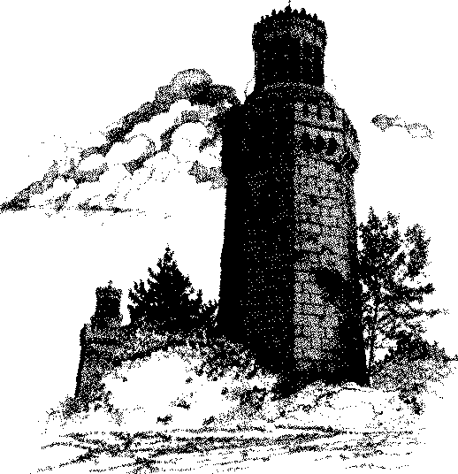 The Navesink Lighthouse station, known as
Twin Lights State Historic Site, was an important maritime navigational aid for ships entering
and leaving ports from the northern New Jersey
coast and New York Harbor. Visitors can take a
self-guided tour of the north tower, the museum,
and grounds. On the site is one of the original
life boat stations built by the U.S. Government
(in 1848) to assist shipwrecked victims along
the Jersey Shore. It was moved to its present
location in 1954.
The Navesink Lighthouse station, known as
Twin Lights State Historic Site, was an important maritime navigational aid for ships entering
and leaving ports from the northern New Jersey
coast and New York Harbor. Visitors can take a
self-guided tour of the north tower, the museum,
and grounds. On the site is one of the original
life boat stations built by the U.S. Government
(in 1848) to assist shipwrecked victims along
the Jersey Shore. It was moved to its present
location in 1954.
Directions: Take state road 36 east from exit
117 of the Garden State Parkway to the community of Highlands and follow signs to the park.
Oversize vehicles and trailers are restricted from
the access road.
Hours: Open daily from 10:00am to 5:00pm -
Memorial Day through Labor Day, and Wednesday through Sunday from September through
May.
Telephone: (732) 872-1814.
Sandy Hook,
![]()
![]()
![]()
![]()
![]()
![]()
Gateway National Recreation Area
Sandy Hook is a 1665 acre barrier beach peninsula located at the northern tip of the New
Jersey Shore. It is the result of accumulations of
sediment moved by the longshore current. The
Hook features seven miles of ocean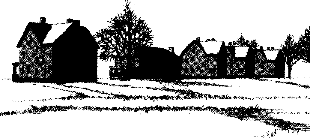 beaches, the
waters of the Sandy Hook Bay, salt marsh,
dunes, a maritime forest, habitat for migratory
shorebirds, the Sandy Hook Lighthouse, and
Historic Fort Hancock.
beaches, the
waters of the Sandy Hook Bay, salt marsh,
dunes, a maritime forest, habitat for migratory
shorebirds, the Sandy Hook Lighthouse, and
Historic Fort Hancock.
Fort Hancock, Sandy Hook Light & Dwelling, and the Spermaceti Cove Life Saving Service Station #2 at Sandy Hook Sandy Hook includes multiple maritime history destinations, all listed on the National Register of Historic Places. Sandy Hook Lighthouse has guided ships into New York Harbor since 1764.
The US Army first fortified the Hook in the War of 1812 and later tested weapons at the Sandy Hook Proving Ground. A century ago. Fort Hancock and a series of gun batteries were built to protect the harbor, and the fort served this role until 1974.
Today many of Fort Hancock's buildings are used by environmental and educational groups. The Fort Hancock story is told at the Fort Hancock Museum and History House, a restored home on "Officer's Row."
Swimming, hiking, fishing, wind surfing, bird-watching, and ranger-guided programs are just a few of the recreational opportunities at Sandy Hook. On busy summer days, the park advises visitors to arrive early in the day as it often reaches its maximum carrying capacity before noon. Visitors can expect to find the usual amenities of a National Park System unit.
Directions: Take state road 36 east from exit
117 of the Garden State Parkway to the community of Highlands, and follow the signs to the
park.
Hours: The visitor center operates daily from
10:00am to 5:00pm. It is closed Thanksgiving,
Christmas, and New Year's Day. The grounds
around Sandy Hook Light are open every day.
Lighthouse tours, conducted by the New Jersey
Lighthouse Society, are offered on weekends
from mid-April to late-November.
Telephone: (732) 872-5970.
Mount Mitchill Scenic Overlook
![]()
![]()
![]()
![]()
This high point (266 feet above sea level)
provides visitors with a panoramic view of
Sandy Hook Bay, the Atlantic Ocean, the New
York City skyline, and historic Fort Hancock
and the Sandy Hook Lighthouse at Gateway
National Recreation Area. Geologic forces
created the uplift. Exhibits interpret the geo-logic story, the skyline views and landmarks,
and help orient visitors to the area. The over-look is part of the Monmouth County Park
System.
Directions: From exit 117 of the Garden State
Parkway, follow state road 36 east to the community of Atlantic Highlands. Take the
Navesink Avenue/Scenic Drive jug-handle (on
the right), and follow the signs to the park
entrance, roughly one quarter mile north of
SR36.
Hours: The park is open daily from 8:00am to
dusk.
Telephone: (732) 842-4000 ext. 256.
Leonardo State Marina
![]()
![]()
The marina remains one of the most popular
and desirable state facilities, largely due to its
proximity to Sandy Hook Inlet and the fruitful
fishing grounds of Sandy Hook Bay. It includes
179 slips and is capable of accommodating
boats up to 45 feet in length. On-site facilities
include a luncheonette, bait and tackle facility,
restrooms, a pump-out station, and boat fueling
station.
Directions: Take exit 117 from the Garden
State Parkway east along state road 36 to the
community of Leonardo. Take Leonard Avenue
north toward Sandy Hook Bay, turn left on
Center Avenue, and right onto Concord Avenue
to the marina.
Hours: The marina office is open daily from
8:00am to 4:00pm. The marina is open twenty-
four hours a day from April 1 to October 31.
Telephone: (732) 291-1333.
Belford Seafood CO-OP
![]()
![]()
 The Belford CO-OP is a cooperative commercial fishing operation located on the shores of
Sandy Hook Bay. The community of Belford is
more than 200 years old and is reported to be the
oldest fishing port on the East Coast. Many of
its fishermen are third and fourth generation. It
maintains a fleet of approximately 30 boats,
including six lobster boats, six clamming boats,
fifteen trawlers, and three seining boats. A retail
sales outlet for fresh seafood and the "Pirate's
Cove" restaurant are maintained at the site.
The Belford CO-OP is a cooperative commercial fishing operation located on the shores of
Sandy Hook Bay. The community of Belford is
more than 200 years old and is reported to be the
oldest fishing port on the East Coast. Many of
its fishermen are third and fourth generation. It
maintains a fleet of approximately 30 boats,
including six lobster boats, six clamming boats,
fifteen trawlers, and three seining boats. A retail
sales outlet for fresh seafood and the "Pirate's
Cove" restaurant are maintained at the site.
Directions: To reach Belford, take exit 117 from
the Garden State Parkway and follow state road
36 east to Main Street, Port Monmouth. Turn
right around the jug-handle crossing SR36 onto
Main. Continue north 1 mile to Port Monmouth
Road, then east (right) to the co-op.
Hours: The interpretive exhibit for this site is
accessible only during daylight hours. The retail
outlet is open Monday through Saturday from
8:30am to 4:30pm, and Sunday from 8:30am to
12:00noon.
Telephone: (732) 787-6581.
Steamboat Dock Museum
![]()
![]()
The Steamboat Dock Museum of the Keyport
Historical Society interprets the history and
maritime traditions of Keyport which was first
settled as a private plantation in 1714 by the
Kearny family. By the 1830s, Keyport had
become a major port for oystering and for
produce on its way to New York City.
Directions: Keyport can be reached by following state road 36 east from exit 117 of the
Garden State Parkway. County road 4 (Broad
Street) connects SR36 to the waterfront at the
museum.
Hours: Open May through September, on
Sunday from 1:00pm to 4:00pm and on Monday
from 10:00am to 1:00pm. Guided tours are
available by appointment.
Telephone: (732) 739-6390.
Cheesequake State Park
![]()
![]()
![]()
![]()
The park offers a variety of outdoor experiences.
During the busy summer months, the park
suggests calling ahead to determine if it has
reached its maximum carrying capacity.
Open fields, salt and freshwater marshes, a white cedar swamp, a sample of the pine barrens, and an outstanding example of a northeastern hardwood forest make up this 1,284 acre park. Look around for wildlife. Migratory birds fly over this area during their annual migrations; the local birding list includes 186 species of birds within the park.
The park offers a variety of recreational activities from swimming and sun bathing at Hooks Creek Lake, hiking along scenic trails, and picnicking, to camping, fishing, and hiking. The Interpretive Center is easily accessible from the Trail system and contains exhibits about the different habitats, plants, animals, and man's former uses of the area.
Directions: Garden State Parkway travelers
should take exit 120 (from the "local traffic"
lanes.) At the first traffic light, turn right onto
Cliffwood Avenue, and follow it to the next
traffic light—the intersection with Gordon
Road. Turn right onto Gordon road, and follow
the signs into the park (approximately ¥2 mile).
Hours: From Memorial Day weekend to Labor
Day, the park is open from 8:00am to 8:00pm,
and the office is open from 8:00am to 6:00pm.
Hours vary during the remainder of the year.
Telephone: (732) 566-2161.
Perth Amboy Harbor Walk
![]()
![]()
Waterfront resources under development as part
of the Harbor Walk include the 1904 Ferry Slip
to Tottenville, Municipal Marina, 1929 Armory,
ca. 1880 Raritan Yacht Club headquarters, 1880
Great Beds Light, and ca. 1780 Kearny Cottage.
Except for Great Beds Light which sits in the
waters of Raritan Bay, all are located near the
waterfront on Smith Street, Front Street, Water
Street, and Catalpa Avenue.
Directions: From Exit 10 of the New Jersey
Turnpike, take state road 440 east to the State
Street exit. Continue on State Street until you
come to the intersection with Lewis Street. Turn
right on Lewis for one block, then left on Catalpa, and follow it to the waterfront.
Hours: A public park area, generally open from
dawn to dusk. You may call the City of Perth
Amboy for details.
Telephone: (732) 442-6421.

 Copyright © 2001-
, Terry Muse
Copyright © 2001-
, Terry Muse
![]()